34-province and 63-province boundaries
Vector tiles for the new two-level model (GADM34) and the former three-level model (GADM63).
Docs gmap cloud
GMap Cloud · Boundaries & coordinates
Show administrative boundaries, find which province and commune a coordinate falls in, and convert coordinates between WGS84 and VN-2000, under both the new and former boundaries.
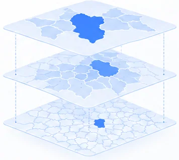
Vector tiles for the new two-level model (GADM34) and the former three-level model (GADM63).
DocsReverse geocoding returns the province and ward/commune (and district for the former model).
DocsFind a province’s VN-2000 TM-3 zone under the new or former boundaries.
DocsConvert coordinates between WGS84 and VN-2000 provincial TM-3 zones or UTM 48N/49N.
DocsConvert WGS84 to VN-2000 (Hanoi, central meridian 105°00′)
curl --get 'https://cloud.gmap.vn/api/idunn/v1/transform' \
  --header 'x-api-key: public-gmap-cloud-x-api-key-demo' \
  --data 'from_crs=wgs84' --data 'to_crs=vn2000-tm3-482' \
--data 'lat=21.0282616' --data 'lon=105.8538789'{
"from_crs": "wgs84",
"to_crs": "vn2000-tm3-482",
"lat": 21.0282616,
"lon": 105.8538789,
"x": 588558.707,
"y": 2326318.739
}x is Easting and y is Northing, in metres. Vietnamese cadastral documents usually label Northing as X and Easting as Y.
Aggregate by new provinces and wards while keeping a link to the former model.
Bring VN-2000 coordinates from drawings and land records onto WGS84 maps, and back.
Find records that fall outside the province or ward named in their address.
Since 1 July 2025, local government in Vietnam has operated a two-level model with 34 provinces and centrally governed cities. The 63-province, three-level model remains useful for historical records and reconciliation.
The API serves application and analytics use. Surveying and cadastral work must verify projection parameters, zones and procedures to professional requirements.
Use the province projection lookup API, or the VN-2000 converter on this site to choose a province and its zone.