Lookup by sheet and parcel number
Get the parcel boundary and former and current ward names from sheet number, parcel number and former ward code.
Docs gmap cloud
GMap Cloud · Parcels & planning
Find a parcel by sheet and parcel number or by coordinate, then check the related planning layers during initial research. Coverage is confirmed for each area.
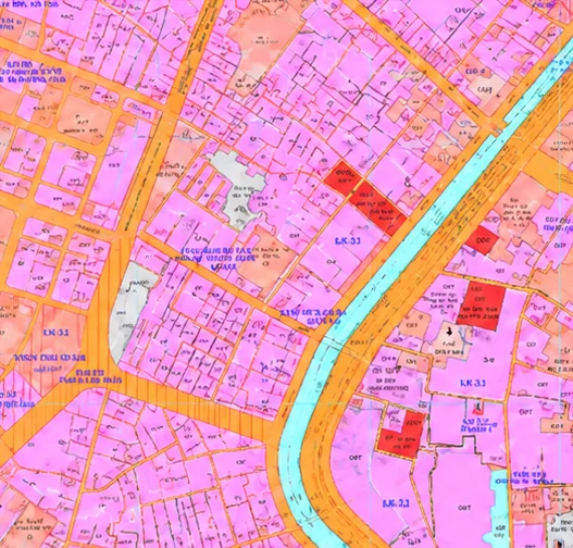
Get the parcel boundary and former and current ward names from sheet number, parcel number and former ward code.
DocsFind the parcel containing a WGS84 location.
DocsQHSDD raster tiles to display with parcel boundaries on a map.
DocsParcel lookup by sheet and parcel number (Da Nang)
curl --get 'https://cloud.gmap.vn/api/hasura/gql/property/parcel/get-parcel-by-cadastral' \
  --header 'x-api-key: public-gmap-cloud-x-api-key-demo' \
--data 'so_to=31' --data 'so_thua=50' --data 'ma_phuong_xa_cu=20323'{
"property_get_prop_planning_parcel_by_cadastral": [{
"so_to": "31",
"so_thua": "50",
"ma_phuong_xa_cu": "20323",
"ten_phuong_xa_cu": "Xã Hòa Châu",
"ma_phuong_xa": "20314",
"ten_phuong_xa": "Phường Hòa Xuân",
"ten_tinh_tp": "Thành phố Đà Nẵng",
"geometry_geojson": { "type": "MultiPolygon", "coordinates": [ … ] }
}]
}First record from a public demo response on 11 September 2026. The former ward code follows the 63-province model.
Locate a parcel, its boundary and related planning layers before a site visit.
Attach parcels and former and current wards to a company’s asset list.
Show parcels and planning in covered areas for user reference.
No. Coverage for parcels, QHSDD and current-status planning varies by area and dataset. Share the province, ward or coordinates you need so GMap can confirm.
The data supports lookup and initial investigation. Decisions must be checked against documents from the competent authority.
Use the former administrative unit catalogue API, or look up the parcel by coordinate when you don’t have the code.